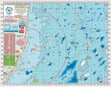
#16 INSHORE SHARK RIVER-MANASQUAN-BARNEGAT INLETS
*All GPS
*Shows Artificial Reefs and Botton Structure
*Out 15 plus miles
*Color coded depth and contour curve lines
*All depths in feet
*5 mile radius lines from each inlet
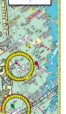
Artificial Reefs Shown with DGPS Coordinates:
Sea Girt Reef
Axel Carlson Reef
Shark River Reef
Barnegat Light Reef
Garden State North Reef
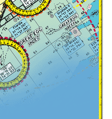
Fishing Grounds:
Shrewsbury Rocks, Mud Hole, Tarpon Lumps, The Farms, England Bank, Angie's Lump, Klondike Banks, Manasquan Ridge, Humpty Dumpty, Little Italy, The Slough, Shark Ledge, Sea Isle Lump, Tolton Hole, Tolton Lump, Olies Lump, 59 ft Lump, Olies Hole, Harvey Cedars Lump, Harvey Cedars Hole, and many more
Joins Charts: #6 Mud Hole Chart Sandy Hook to Ocean City NJ
#10 Tuna Chart Barnegat to Ocean City MD
#11 ICW Barnegat to Ocean City with entire Mullica River
#12 Canyon Chart Hudson to the South Poormans
#22 ICW Manasquan Inlet-Barnegat Bay-Manahawkin Bay
|