|
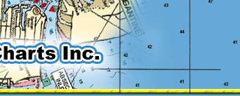
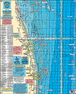
#37 GPS Inshore Bottom Structure Chart from St. Lucie Inlet to Jupiter Inlet to Palm Beach Inlet (Lake Worth) to Boynton Inlet to Boca Inlet to Hillsboro Inlet out 20 miles
LOCAL KNOWLEDGE 'HOT SPOTS' AND FISHING GROUNDS
Shows peaks and deep drop holes not shown on other charts
Color coded depth contours and curve lines.
Laminated.
Enlarged Latitude & Longitude numbers for easy positioning.
Shows 5 mile radius lines from every inlet.
Fishing Grounds: "Sailfish Alley" Peck Lake Ledge, Hobe Sound Bars, Sea Bass Rocks, Pushbutton Hill, Loran Tower Ledge, Jupiter Ledge, Jupiter High Bar, Juno Ledge, Lost Tree, The Zoo, The Ranch, Bud Bar, Brown House, Gulfstream Ledge, Seagate Hole, Sloane's Curve, Hogfish Hole, Boil, Horseshoe, Gar's Spot, Tile Hole, Middle Lump, East Lump, First Peak, North Peak
271+DGPS Wrecks and Reefs: Ernst Reef, Sirotkin Reef, LC 6, Traffic Barge, Roosevelt Bridge, Owl Yacht, West 400 Reef, Davit T, Inlet Barge, Wild Cat, Fast Eddie, Mango 700 Reef, Loran Tower Reef, West Palm Fishing Club Reef, Governor's River Walk Reef, Radnor Reef, Ande Reef, North Breakers Reef, South Breakers Reef, Bath and Tennis Reef, Fay's Reef, Pep Reef, Boca Reef #1, Boca Reef #2, Hillsboro Reef, Papa's Reef, Meuller Reef, Rinker Deep Reef, Eagle Scout Reef, Chris Coffman Reef, Anglin Pier Reef and Wrecks like: Bullshark, Miss Jenny, King Neptune, Bud Bar, Noula Express, Shrimper, Tug Titan, Rankin, 10cent Bridge Rubble, Gulf Pride, MGIII, M/V Zion, Sea Miost, Princess Anne, Skyecliffe, Ancient Mariner, Miller Lite, Rodeo 25, Guy Harvey, Caicos Express, Peter B. McAllister
Joins: #46 Loxahatchee River Chart
#36 Inshore Sebastian Inlet to Jupiter Inlet
#48 Northern Swordfish Chart
#35 Swordfish Chart
#40 Upper Bahamas
#47 ICW North Palm Beach to Ft Lauderdale and Hollywood
|